Description
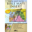
This incredible full color 44-page Bible atlas has clear plastic overlays of modern-day cities and countries. Now you can have "Then and Now" Bible maps inside your Bible. It fits conveniently in the back of your Bible or in your Bible cover. This is the perfect way to add full-color bible maps to even the most economical KJV Bible. This has double the maps and more color than any other Bible map insert on the market.
Features:
- 44 pages
- 8 plastic overlays
- All maps in full color
- Larger print than other Bible map inserts
- Every major city in the Bible
- Bible timeline
- Index
- Separate maps for each of Paul's Journeys
- 5-1/2 x 7-3/4 inches.
Publisher's Description:
Enjoy having 22 easy-to-read, full-color maps that you can easily slip inside your Bible cover with this incredible Bible Map Insert! Now you can easily see where where biblical places were 3,000 years ago and where they are today!
Tired of flipping to the tiny maps included in the back of your Bible and still not seeing the information you need? Most study Bibles provide maps showing only the position of cities during Bible times in super small print, making it hard for you to clearly see where Bible places are located today. With Rose's ultra-slimline Then and Now® Bible Map Insert you can clearly compare biblical cities with their modern day locations at a glance! Features larger print, easy-to-read type, and 8 clear plastic overlays showing the location of modern cities and countries in red. Packed with maps, time lines, charts, and fascinating facts, this is a must-have resource for any Bible study.
Enjoy Having These 5 Key Features:
- 22 full-color maps, showing the Holy Land, the Middle East, Paul's missionary journeys, and more
- 8 clear plastic overlays showing modern day cities and countries in red
- Old and New Testament time lines —shows Bible events next to world history events
- An index showing every major place in the Bible
- Quick-reference charts and diagrams that will add depth to any Bible study! Covers key topics:
- Easy-to-follow diagram showing the families of Abraham, Isaac, and Jacob
- Chart on 12 judges and prophets, location, to whom they prophesied, date, etc.
- Incredible diagram of the Tabernacle layout (birds-eye view)
- Diagram of Jerusalem during Jesus' time
- Quick-reference charts listing Paul's missionary journeys and an overview chart of Paul's letters
See Fascinating Facts at a Glance:
- Daniel was captured as a POW and taken to Iraq; he lived there the rest of his life.
- The wise men were probably from Iran or Saudi Arabia.
- Abraham crossed Iraq and Syria to get to the Promised Land (The Holy Land today).
- The ruins of Nineveh (from the story of Jonah) are in Northern Iraq near Mosul in Kurdish areas.
This ultra-thin booklet fits inside most Bible covers and it features larger print, more maps, and more clear plastic overlays than any other insert available (44 Pages; 5-1/2 x 7-3/4 inches).
3 Reasons Why This is the Best Map Insert Available:
Compared to other products on the market, Rose's Then and Now® Bible Map Insert features—
- MORE full-color maps
- MORE clear plastic overlays showing where Bible places are today
- LARGER font size 8-10 pt. font size; average insert has only 5-6 pt. font size
Now, you will know where Bible places are today and will discover how Location, Location, Location matters within the Bible with Rose Publishing's Then and Now® Bible Map Insert.


